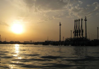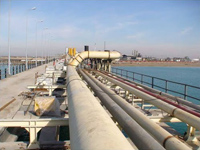
GEOGRAPHY /MAIN FEATURES:
This port is located 10.4 km east of Bandar Imam Khomeini.
- LAT-LONG : 30º28′ : N – 49º11′ E
- UNCTAD LOCODE : IRPMA
- ADMIRALTY CHART/PILOT : 1269/63
AUTHORITY:
- National Iranian Oil Co. (N.I.O.C.)
- Port of Mahshahr
- The port is presently operated by NIOC
- Abadan refinery
APPROACH / ANCHORAGE:
No anchorages at Port of Mahshahr or Mahshahr roadstead. After leaving the Khor Musa bar, the channel is followed up the Khor Musa for about 51 km to the anchorage at Port of Imam Khomeini, where all inward bound vessels required to anchor for the purpose of granting pratique. Channel pilot will disembark and Oil company berthing master will board incoming vessels, because Oil company has its own pilotage system in this part of channel. Shortly after leaving Bandar Khomeini, channel to Mahshahr is entered, which is well marked by light beacons to entrance of Port of Mahshahr . Distance from Bandar Khomeini anchorage to port of Mahshahr, approx. 11.2 km.

ACCOMMODATION:
BERTHS
- Packed Products Jetty
- NIOC Cargo Jetty
- Bulk Liquid load/discharge Jetty no.1
- Bulk Liquid load/discharge Jetty no.2
- Bulk Liquid load/discharge Jetty no.3
- Bulk Liquid load/discharge Jetty no.4
- Bulk Liquid load/discharge Jetty no.5
- Bulk Liquid load/discharge Jetty no.6
COMMODITIES
- Only accommodates barges and other small crafts for transhipment of packed products to vessels at main jetties.
- General purpose
- Used for load/discharge of clean products
- Mostly used for loading of fuel oil
- Used for load /discharge of clean products
- Used for load /discharge of clean products
- Mostly used for loading of fuel oil
- Rented by PCC for exporting petrochemicals
PIER RESTRICTIONS:
- DRAFT : 38-42 feet at different main loading jetties
- L.O.A. : Max. 780 feet
- BEAM : No limitation
- Berthing : No limitation, possible at day and night
NOTE : The port can accept Tankers of up to 80,000 tons dwt for load / discharge of different Liquid bulk (oil products/ petrochemicals) commodities.
