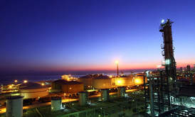
GEOGRAPHY /MAIN FEATURES:
Bandar Imam Khomeini is situated in the north-western coast of the Persian Gulf, 100 kilometers east of Abadan and Khorramshahr and 175 kms Southeast of Ahwaz.Because of its characteristic position and possession of a natural channel “The Khor Musa” with a length of about 78 km, it is considered one of the most important ports of the country.
The Khor Musa is one of the most important natural channels which does not need dredging.
The water depth in this channel differs between 30 to 42 feet during high and low tides. Ships with capacity of 100,000 tons can easily pass this channel and dock at the various jetties there. This port is the first in the country which in addition to paved roads and air links, is also connected to various points of the country through railway system.
Same as other ports in Iran, pilotage is compulsory at this port. Vessels should anchor at the outer buoy latitude 29 degree 59 seconds North, longitude 49 degrees 04 seconds East or, when weather is clear, proceed towards fairway buoy and await a pilot.
A massage addressed to agents through B.I.K. radio should be sent 12 hours prior to arrival at outer buoy.
POSITION:
- Longitude 49 degrees 04
- seconds East latitude 30
- degrees 25 seconds North
- Distance to Tehran : 927 kms
- Distance to centre of province : 185 kms
- Distance to centre of the city : 27 kms
- Distance to nearest commercial airport : 100 kms
- Connection lines to Tehran and other cities : By paved road and railway
- Min/Max yearly humidity : 15-99%
- Min/Max yearly temperature : 6-50 degree Centigrade
- Time Zone : GMT + 3.5 H
SHORE EQUIPMENT/ FACILITIES:
- Cranes : 40 Units
- Tractors : 53 “
- Lift rucks : 119 “
- Trailers (flat beds) : 142 “
- Push Trucks : 10 “
- Rail Cranes : 6 “
- Gantry cranes : 2 “
- Transtainers : 2 “
- Top Lifters : 5 “
- Grain Vacuators : 5 “
BERTHS:
Name | No. | Length(m) | Depth(m) |
Old Eastern Wing | 3 | 540 | 13.0 |
Old Western Wing | 3 | 540 | 13.0 |
Four – post jetty | 4 | 771 | 12.5 |
Five-post container berths | 5 | 1051 | 10-15 |
Five-post general cargo berths | 5 | 911 | 9.8 |
Six-post | 6 | 1093 | 9.8 |
Silo jetty (imports) | 1 | 280 | 15.0 |
Silo jetty | 1 | 280 | 14.0 |
Barge harbor; for 24 barges | – | 842 | 6.5 |
Gulf jetty | 1 | 207 | 6.6 |
Trans-Terminal jetty | 1 | 75 | 3.6 |
Ore imports jetty | 1 | 220 | 10.0 |
SHELTERED AND UNSHELTERED WAREHOUSES:
- Total area of sheltered warehouses: 287,940 square meters
- Total area of unsheltered warehouses: 10,980,790 square meters
MARINE EQUIPMENT:
- Barges 9 Nos.
- Tug-boats 11 “
- Floating cranes 2 ” (at Silo berths only)
- Grab dredger 1 “
- Dredgers 5 “
- Fresh water barge 1 “
- Boats 10 “
- Fire-fighting tug 1 “
- Bunkering barge 1 “
